
“…shiver me timbers
I’m a-sailin’ away”
—Tom Waits, Shiver Me Timbers
While confusing, all three of the names entitling this post refer to the same place. At one time Dunmore Town was the capitol of the Bahamas and was also a prosperous shipbuilding town. Harbour Island, the island on which Dunmore Town is located, is roughly 3 1/2 miles long and 1 1/2 miles wide. The town occupies most of the island. Finally, “Briland” is the local and affectionate name for the area. It’s a contraction of Harbour Island; imagine “Harbour Island” becoming something like Bour’island then “Briland”. The locals have a wonderful half-British, half-islander accent—to hear them say “Briland” is musical.
For the past 6 nights, I’ve been anchored up about a quarter mile off the shore on the west side of Briland. Over the island and to the east, lies the Atlantic Ocean that I hope to be sailing this afternoon. Last night, I stayed in a marina comfortably tied to their docks. While I sleep on Hazel James at a marina, I enjoy hot showers, laundry, dock space to organize and fresh water to wash down. While at anchor, most days I’ve been paddling my inflatable kayak into town, beaching it and locking it to a tree, and exploring the island. There’s probably no need to lock it given the culture here, but since it’s my one-way on and off of HJ, I don’t want anyone messing with it.


At anchor at night, a boat is to display an all-around (360 degree) white light referred to as an “anchor light”. This warns other mariners to keep clear. I’ve gotten smart on my anchor light and if there is any chance I won’t be back to HJ until after dark, I’ll flip on her anchor light before I depart in the kayak even if it’s in the middle of the day. It’s nice to not rush a dinner just to get back for the anchor light. It also makes HJ easier to find in the dark.

I’ve never seen Bermuda’s pink sand beaches, but those who have seen both Bermuda’s and Briland’s say that Briland’s are pinker. I took this picture on an overcast day that doesn’t really do it justice.


It’s a pretty little town. Lots and lots of chickens and golf carts. Even when anchored up, when I wake before sunrise I hear a brilliant cacophony of roosters crowing.


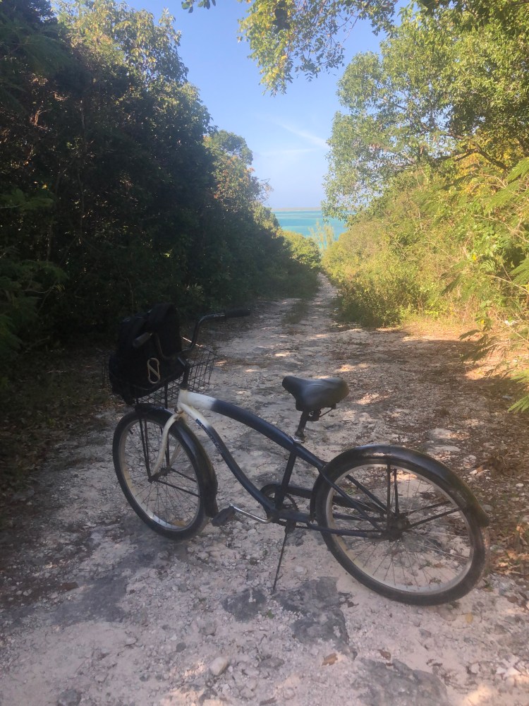
I think what impresses me the most is that the people are so nice. It’s hard to walk anywhere in this town without someone in a golf cart slowing down and motioning for me to hop on—which of course I do. Not once in my 5 or so excursions, with lots of walking through all sorts of streets and paths, did someone ask me for something or try to sell me something. I rented a bicycle one day which of course came without a lock because I didn’t need it.

And did I say chickens all over the place?


There’s no airport in the town so the only way on or off the island for people and provisions is by boat. If you would ever want to visit, Delta (via Atlanta) and American (via Charlotte) have jet service to the North Eleuthera airport and Briland is a 10 minute water taxi away. It’s also a 30 minute fast ferry ride between Spanish Wells and Briland if you wanted to stay in one town and do a day-trip to the other. I was anchored up within view of the “Government Dock” where all ferries, water taxis and supply ships dock, and the traffic in and out is amazing. The Government Dock is also where customs and immigration are located if you were to make Dunmore Town your international port of entry.


As I said earlier, I spent yesterday, last night and am spending this morning at a marina. I’m getting myself and Hazel ready to head out into the Atlantic for what I hope to be a 960 nautical mile sail to the Virgin Islands. On a solid day, HJ can put 120-130 miles under her keel—however, that’s highly dependent on sea-state, and wind speed and direction.
The two biggest challenges I see are: getting out of Harbour Island, and my first leg of “easting” (making progress to the east). A few days ago, I paddled my kayak down to Harbour Mouth, the inlet between the bay where I am now and the Atlantic. The inlet was nasty at that point with breaking waves, but the wind had been blowing 15-25 knots for several days so that was to be expected. We’ve had relatively benign winds yesterday and last night so I should be good there. What worries me more is that before I get to the inlet, there is a narrow and shallow channel I need to navigate. When I scouted the channel and sounded it with a lead line (measured its depth), I got 6 1/2 to 7 feet. Per documentation, HJ draws 5 feet but she’s probably a few inches deeper at the moment given the provisions and water she’s carrying. Fortunately there is a locals-bouy marking the channel (to be honest, it’s just a white boat fender). In addition to GPS and waypoints, I’ll want to keep that bouy about 10 feet off my port beam as I work my way out into the ocean. Boy, will I be happy if (when?) I clear the shallowest water and start to see HJ’s sonar showing the bottom dropping away. Fortunately the shallow water is well inside the inlet itself (the interface between the bay and the ocean), so I don’t need to deal with both shallow water and the confused seas that occur in an inlet at the same time. If all goes according to plan, I’ll have several minutes between navigating the shallows and dealing with the inlet. After clearing the inlet, it’s imperative that I continue “steaming” (under engine power) a half-mile or so out into the Atlantic before setting sail. If you look back to the picture above with the caption “Walking down to the Atlantic beach” you can see the coral off the beach—you want to stay well clear of that. Given the shallow water, I’ll be doing all of this at or just after high tide which is at 12:21 PM local time (still EST or GMT -5). Couldn’t be better timing for the high-tide as the sun will also be high, improving my ability to read the water. The whole process gives me so much respect for early mariners who did all this with neither GPS, accurate charts (or sometimes any charts), nor engines.

From there, my next challenge will be making 360 nautical miles of progress due east. My current coordinates are 25 degrees 30 minutes North, 76 degrees 38 minutes West. My first waypoint, 360 miles to the east, is 25 degrees 40 minutes North, 70 degrees 00 minutes West. Of course there’s “nothing there” at that waypoint, it’s just a point in the ocean. Fingers crossed I get good winds and wind direction for this first leg (anything but wind out of the due east). The goal with this first leg is to stay north of the trade wind belt as the “the trades” blow consistently from the east. From there, I plan to bend to the south and pick-up the easterly trades. I met a guy in the Berry Islands a couple weeks ago who had made this run to the Virgins several times. He said, “Say as high as you can, as long as you can.” That is, stay north until you are well east, and then turn south.


While I’m out at sea (I’m thinking 10-15 days) I’ll be communicating with my son Jack daily and he’ll be posting position reports on the blog from time to time.
This is the plan. As said before, the larger goal of adventure, challenge, solitude, and time to think, mourn, grieve and hope is being exceeded in every way. Even if the future doesn’t unfold per plan, the goal is far more important. Shiver me timbers, I’m a-sailin’ away.